
Proposals
A sustainable development
The proposal offers an exciting, sustainable development with new open green spaces and enhanced walking/cycling routes that will benefit both new and existing residents. The development has been designed to create a sense of place that reflects the character of Thaxted.
Key features
Benefits for the new and existing community
- Drainage and flood solutions sympathetically designed to prevent flooding to the site and wider area.
- Footbridge over Cripsey Brook to the south of the site linking the Public Rights of Way network and enhancing connectivity.
- Additional tree and landscape planting which in keeps with the character of the community woodland to the east of the site.
The site
Site location and masterplan
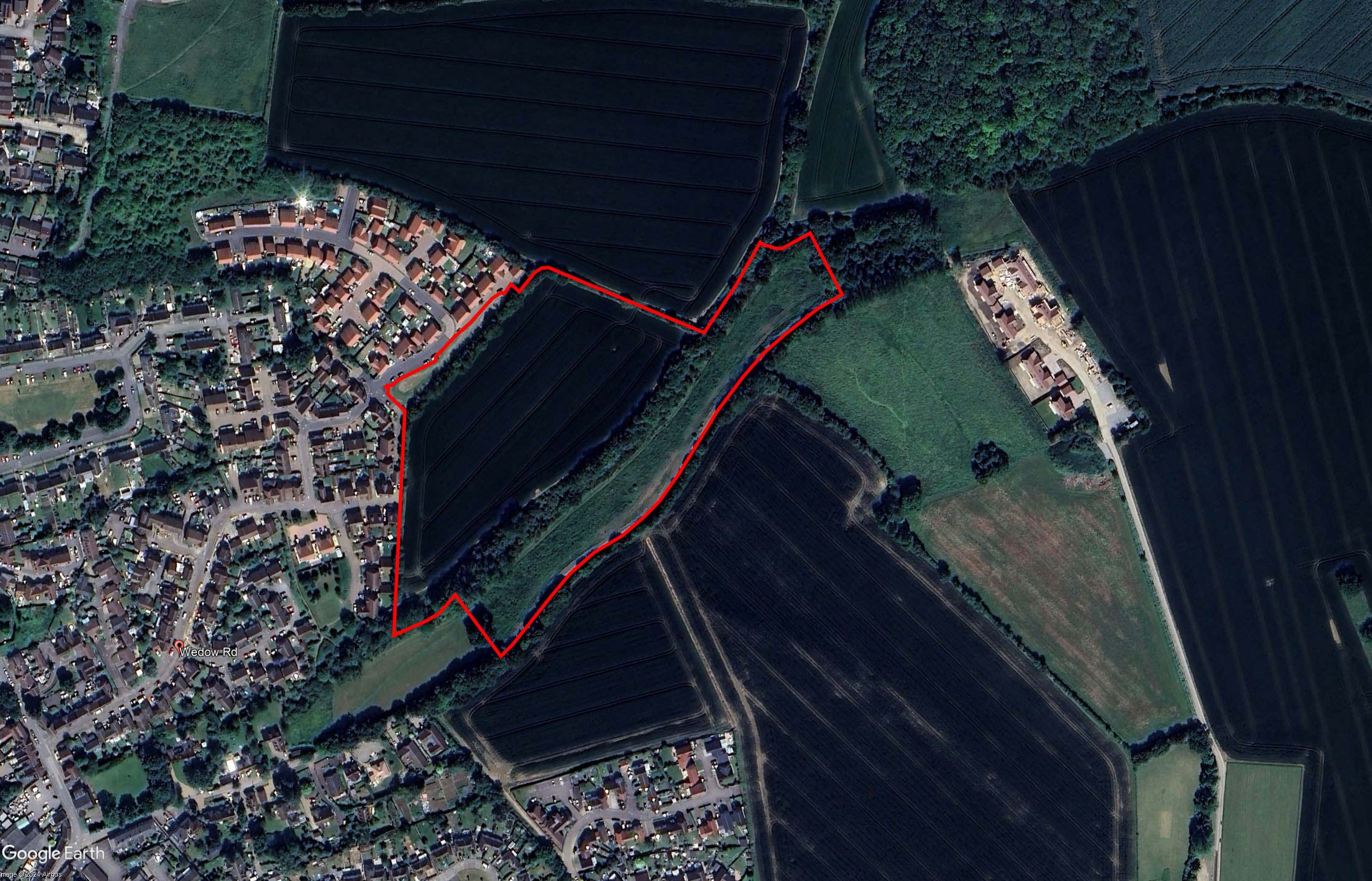
The site is located to the East of Wedow Road, Thaxted and borders onto Copthall Lane to the south, with Cripsey Brook running through the proposed new open space.
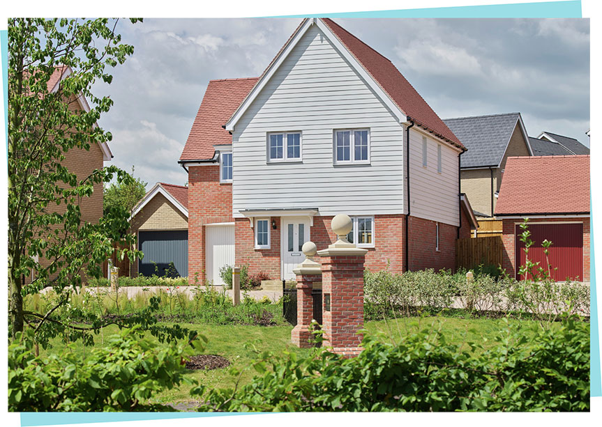
The proposed development will deliver 49 high-quality new homes with a diverse mix of house types to suit a range of needs. From a bungalow to accessible ground floor maisonettes to larger family houses, with 40% allocated for affordable housing.
The housing mix and tenure provides the opportunities for first time buyers to get onto the housing ladder, family homes, and those who are wishing to downsize but remain in the area.
Access arrangements
Delivering the agreed access arrangements
The permanent access arrangements have already been approved as part of the Outline permission. This means the site will be accessed off Elers Way via a new priority junction which will serve as the vehicular access point for the new homes. A spine road from the main access will provide access to the rest of the development.
The proposals deliver a number of walking and cycling routes around the site with a landscaped buffer. There are a number of potential connection points for the site to link into existing Public Rights of Way – creating vast opportunities for active travel and provide the opportunity for new residents to have easy access open green space. Countryside is keen to hear from residents about how they want these new pathways to look.
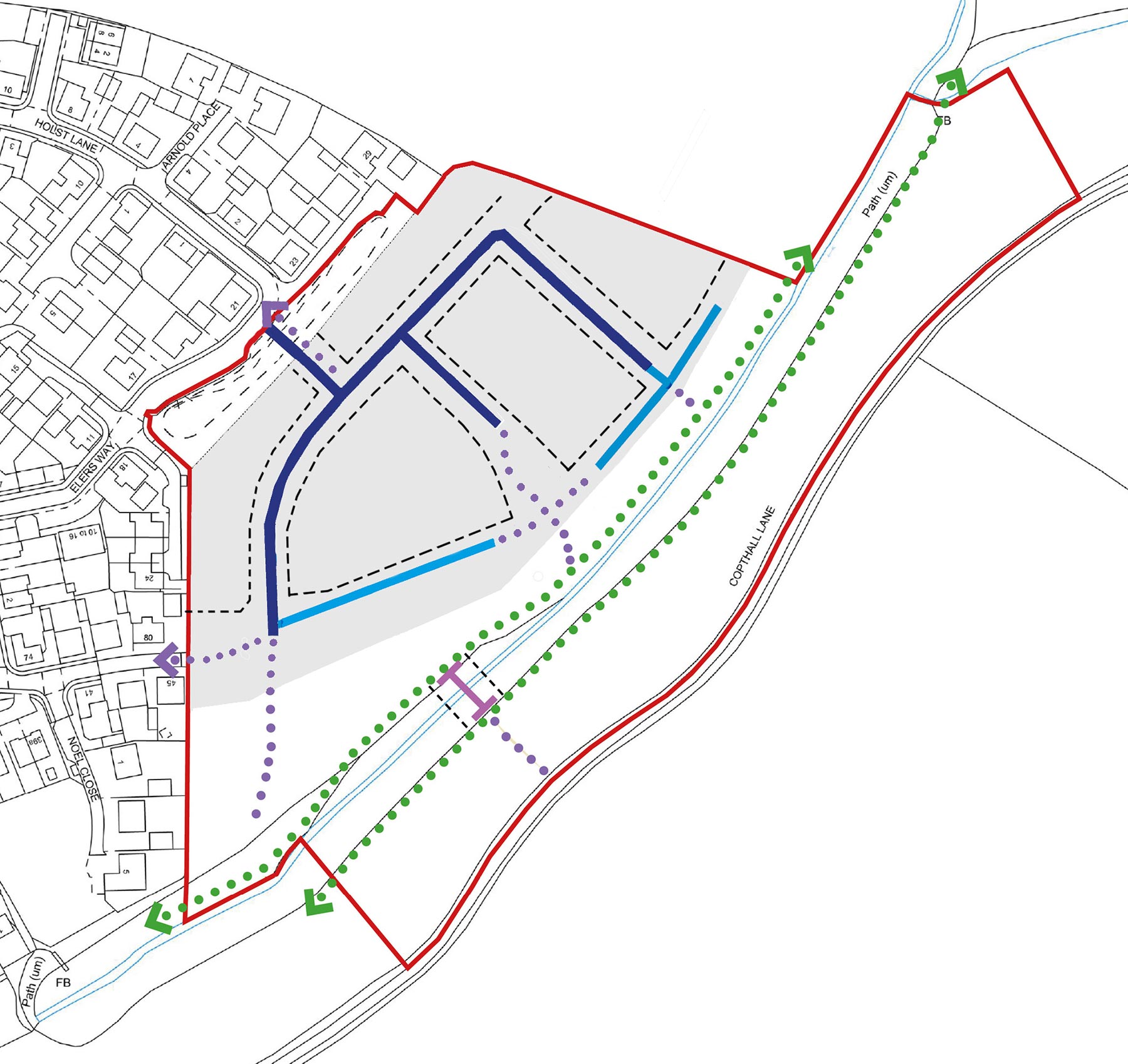
 Site boundary (4.5ha / 11.5acres)
 Development area
 Access / minor access
 Single sided street
 Existing footpaths / PROWs
 Proposed footpath connections
 Proposed pedestrian footbridge
 Zone within which proposed routes will be located
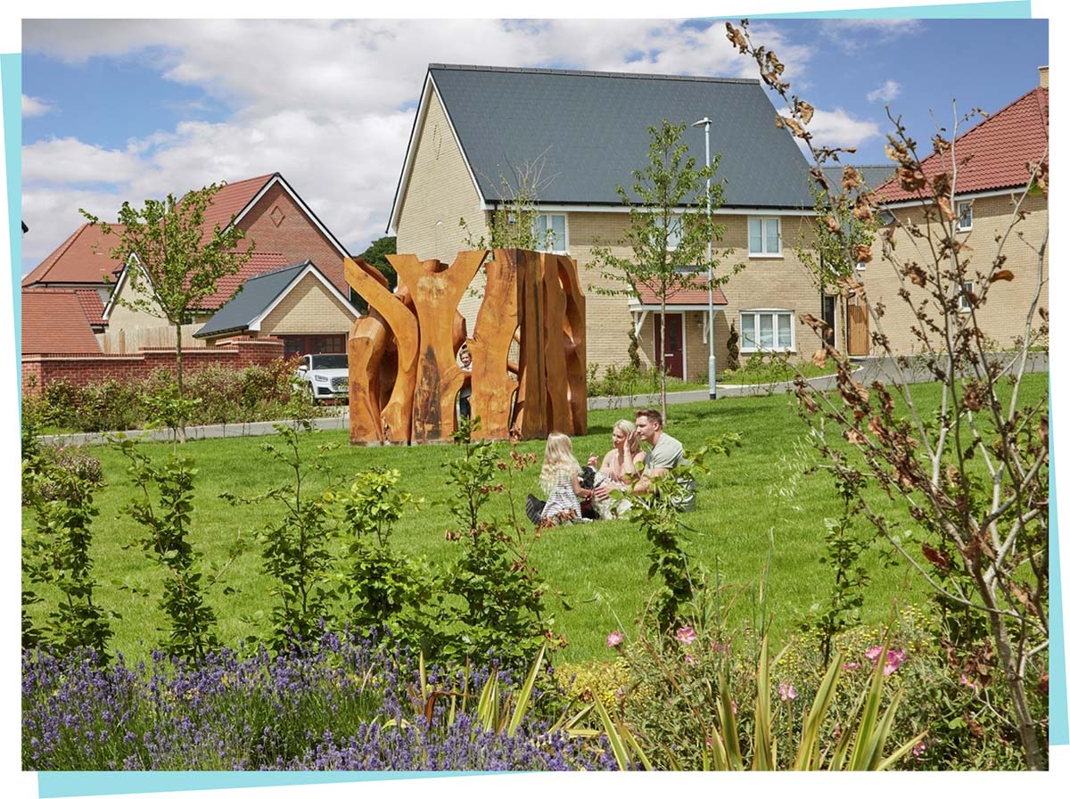
New open green space and biodiversity
Delivering green open space for both new and existing residents
The development has been designed to be landscaped led with many green credentials. The scheme has been designed to achieved biodiversity net gain and biodiversity enhancements for the development include permeable fencing for hedgehogs, installation of bat and bird boxes, bee bricks and log piles which all create a diverse environment.
Existing trees, hedgerows and planting will be retained and enhanced where possible, including additional planting and landscaping across the site as part of the development. Not only to be in keeping with the community woodland but to enhance the existing soft screening of the site.
As part of the consultation event, Countryside would like to hear from local residents about their priorities for this new open space.
Timeline
How will the project move forward
Timeline is subject to change due to planning and consultation.
Winter 2024
Consultation with local residents on design and open space plans. Submission of reserved matters planning application.
Spring 2025
Access has been made available via the approved permanent access point to enable site investigations and surveys. The access point will be secured.
Summer 2025
Currently anticipated planning committee determination of planning application.